There were many items on their agenda, but hands-on learning about how researchers count caribou topped the list—at least when it came to fun! With a new population estimate for the Bathurst Caribou herd upcoming this fall, the activity rated high in importance too.
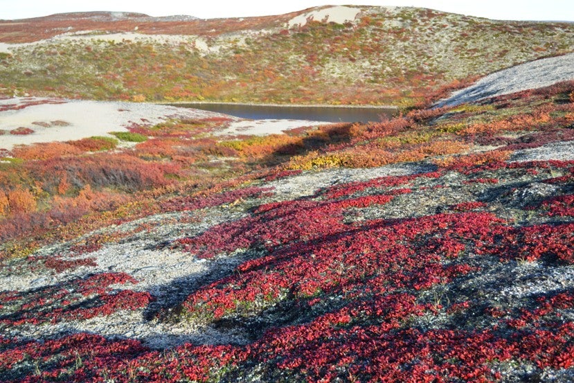
This fall’s Board meeting was held at ENR’s Tundra Ecosystem Research Station at Daring Lake, about 300 km northeast of Yellowknife. One of our Board members, Steve Matthews, played a role in founding the Research station in 1994 and did a great job as host, giving us a tour of the facilities and the research currently underway there. The Station hosts various research and monitoring projects related to contaminants, climate change, resource development, biodiversity, and species at risk.
There were several items on the Board’s agenda including updates on the proposed NWT Wildlife Act; the Species at Risk Act (SARA) Relisting for the Grizzly Bear; the Mackenzie Bison and Anthrax situation; Fortune Minerals NICO Project; the draft Bluenose Caribou Management Plan; Barren-ground Caribou Technical Working Group; and the work that was being done to come up with a new population estimate for the Barren-ground Caribou.
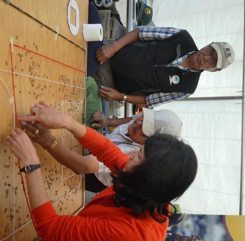
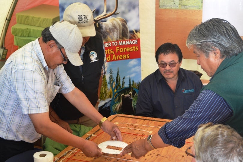
Karin Clark, the WRRB’s wildlife management biologist, took the Board members through a hands-on activity to demonstrate how calving ground surveys are conducted. In anticipation of the new population estimate for the Bathurst Caribou herd that will be out later this fall, the exercise showed specifically how a population estimate is derived.
Using an activity featured on GNWT's educational DVD Caribou and People: A Shared Future, Board members worked through a mock sample of a caribou calving ground survey. Beans representing caribou were scattered over an area which was set up as a grid with fishing line. The grids simulated the transects—or strips of ground spaced a certain distance apart—that researchers fly over when conducting the survey. Board members had to figure out the best route to fly to cover the most representative area of the calving ground and still have enough fuel to make it back to base camp—not an easy task, they discovered! But it was a great activity and lots of fun and the Board came away with a good understanding of what’s involved in setting up and conducting photo census aerial surveys –and counting caribou.
The Board would like to thank Lynda Yonge, Director of Wildlife for ENR (GNWT) who gave a presentation on the changes to the NWT Wildlife Act. The next Board meeting is scheduled for November.
For more information on Caribou and People: A Shared Future, please contact Tasha Stephenson, Public Education Specialist, Environment and Natural Resources, GNWT at tasha_stephensen@gov.nt.ca or call 867.873.7064
Gallery Photo Descriptions:
The photos in the Gallery below show the caribou calving ground survey simulation activity. Board members acted as pilots,oberservers and data recorders to get a feel for how an aerial survey is done. Board members learned how biologists estimate caribou population through aerial surveys over a specified area. Caribou are counted visually from the air in low density areas and photos are taken in higher density areas for caribou to be counted later.
The photos also show you this unique research station perched on the barrenlands and some of the richness of the area's natural, geological and archaeological features.