
This fall, WRRB Executive Director Jody Pellissey travelled to Inuvik to attend the 23rd NWT Board Forum held November 27-30, 2017. The Forum is made up of resource management organizations, including the WRRB. Bringing these bodies together annually provides an opportunity to learn from one another about resource management issues, and to work on initiatives of common interest, such as training for board members and staff.
Resource management encompasses a broad range of activities that includes land use planning, environmental assessment, land and water regulation and resource management –all areas that are represented in the Forum membership. The NWT Board Forum is a way to help coordinate resource management in the NWT.
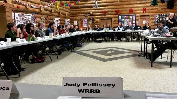 The NWT Board Forum met at Ingamo Hall in Inuvik. (Photo: Jody Pellissey, WRRB)
One of the areas of common interest on the agenda for discussion was legislative changes to the Forest Management and Forest Protection Acts, Waters Act, Environmental Protection and Environmental Rights Acts, and the Minerals Act, as well as development of protected areas legislation. The GNWT, along with Aboriginal Governments, is working towards modernizing laws to address current challenges, reflect post-devolution scope of powers, streamline regulatory processes, and increase efficiencies. The Acts are expected to be completed by the end of 2019. The Forum also discussed youth engagement and public participation. Breakout groups discussed how best to engage with and encourage youth to participate in the various resource management fields. Ideas ranged from social media to internships.
Front and centre to the meeting, though, was the new Inuvik to Tuktoyaktuk Highway, which opened last month and connects Canada from sea to sea to sea. Forum members heard presentations from the GNWT’s Department of Infrastructure, the Environmental Impact Review Board, the Inuvialuit Water Board, GNWT, Department of Lands, and Inuvialuit Land Administration on environmental management, including wildlife in the region along the highway corridor. The rolling terrain there is underlain by continuous permafrost, and a primary concern in building the road was the importance of not altering or damaging the permafrost. Permafrost –the permanently frozen layer below the earth’s surface—has a profound effect on the availability, quality and flow of water. Thawing of permafrost can change water drainage patterns, causing lakes or wetlands to expand or to drain, in turn resulting in a change in surrounding vegetation communities.
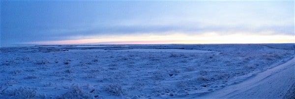 Panorama view of the numerous lakes and rolling tundra along the new Inuvik-to-Tuktoyaktuk highway corridor. The new all-season road provides views of the expansive tundra from both sides. (Photo: Jody Pellissey, WRRB)
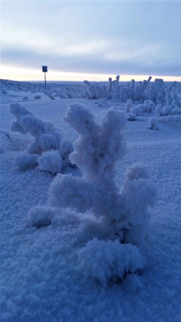 Frosted vegetation on side of new Inuvik-to-Tuktoyaktuk Highway. (Photo: Jody Pellissey, WRRB)
It is because of permafrost and the numerous lakes in the Tuktoyaktuk peninsula that the unique landforms known as pingos are formed. These cone-shaped hills with hearts of ice dominate the horizon near Tuktoyaktuk and are unique to areas of permafrost. They are created through processes of freezing and thawing when the pressure of freezing groundwater pushes up a layer of frozen ground. Pingos grow in much the same way that a can of pop expands as it freezes. They range from budding "newborns" to "elder" pingos that are shrinking and slumping.
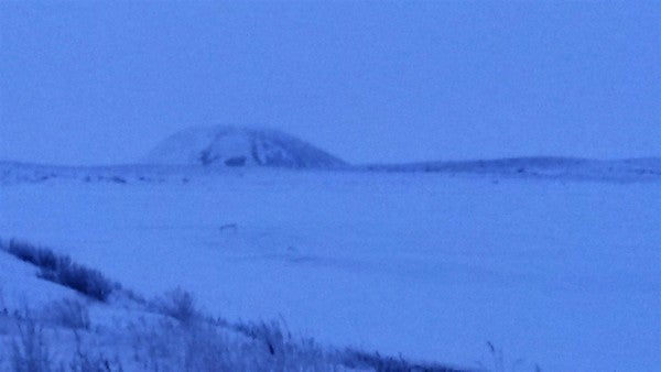 Pingo rising out of the mostly flat tundra landscape. The area surrounding Tuktoyaktuk has about one-quarter of the world's pingos, about 1,350 of them, some as old as a thousand years, at different stages of growth or collapse. Just outside the community is the second-largest pingo on Earth, estimated to be 1,300 years old. (Photo: Jody Pellissey, WRRB)
Approximately 23 species of land mammals make their home in the region of the highway, and 137 bird species are known in the area for at least part of the year. Developments such as roads may affect wildlife to varying degrees, depending on the species. Research and monitoring are important to ensure the road does not have significant negative effects on the water, terrain, or wildlife habitat.
Forum Members toured the new highway, travelling 138 km to the Inuvialuit community of Tuktoyaktuk, on the southern shore of the Beaufort Sea in the Arctic Ocean northeast of Inuvik.
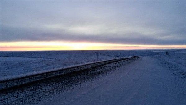 Travelling to Tuktoyaktuk on the new Inuvik-to-Tuktoyaktuk highway. (Photo: Jody Pellissey, WRRB)
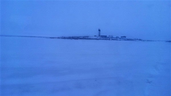 Former DEW Line station in Tuktoyaktuk. Radar domes were installed on remote Arctic tundra beginning in the 1950s as part of the Distant Early Warning (DEW) Line to monitor air traffic and detect possible Soviet aircraft or missiles during the Cold War. Today, it is decommissioned and used as a radar station. (Photo: Jody Pellissey, WRRB)
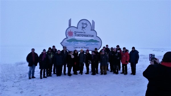 Arriving at the end of the road in Tuktoyaktuk, "Land of the Pingos". The community's location on Kugmalit Bay, at the eastern mouth of the Mackenzie River Delta, has been used by the Inuvialuit people for centuries as a camp for harvesting caribou and hunting beluga whales. The Inuvialuit have used pingos as lookouts for sighting caribou on the tundra or seals and whales on the water. Pingos have also been used for navigation and as ice houses for storing food. (Photo: Jody Pellissey, WRRB)
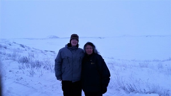 WRRB Executive Director Jody Pellissey and Wek’èezhìı Land and Water Board Chair Violet Camsell on the shore with pingos in the background. (Photo: Courtesy of Jody Pellissey, WRRB)
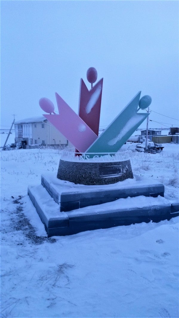 Trans Canada Trail Trailhead Marker in Tuktoyaktuk to connect Canada from coast to coast to coast. (Photo: Jody Pellissey, WRRB)
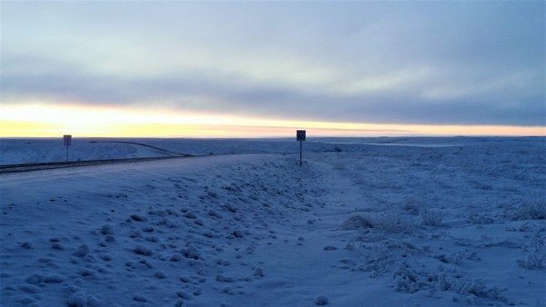 Well above the Arctic Circle, 24 hours of darkness falls soon in Tuktoyaktuk. (Photo: Jody Pellissey, WRRB)
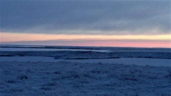 View of last light from the highway (Photo: Jody Pellissey, WRRB)